Point Groups and Surfaces
Point Groups and Surfaces
A point group is a named rule that selects survey points. A surface is a TIN triangulated from one or more point groups. Groups feed surfaces, so build them in that order.
Point Groups
Ribbon: Survey → Groups
A group stores a rule, never a member list. Membership is recomputed from the current points every time it is asked for — so a point imported after the group was defined joins it with no edit, and a deleted point leaves nothing behind.
Creating a group
Press New point group. Give it a name — names are unique within the drawing, and an empty name is refused ("Point group name cannot be empty…", "A point group named … already exists — rename refused.").
The rule
Include points matching ANY of:
The criteria combine as a union (OR). A point joins the group if it matches any filled-in criterion.
| Criterion | What it matches |
|---|---|
| Point numbers | Ranges and singles, e.g. 1-500, 1200, 1400-1450. Reversed ranges are normalised |
| Description matches | Wildcard against the point's description |
| Raw description matches | Wildcard against the point's raw field code |
| Group picks | Points picked by hand in the drawing. Always members, whatever the other criteria say |
Wildcards are case-insensitive: * matches any run of characters including none, ? matches
exactly one, everything else is literal. Case-insensitivity is deliberate — field codes are typed
in the field, and eg meaning something different from EG would be a trap.
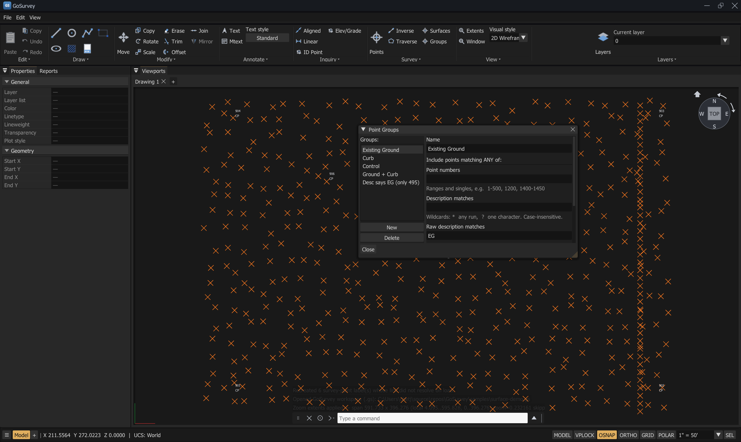
A group keyed on Raw description matches = EG, so office edits to the description cannot
break it.
An empty rule matches nothing, not every point. The dialog says so: "No criteria set — this group contains 0 points." Treating "no filter" as "match everything" is how a whole drawing ends up in a surface by accident.
Working with a group
| Control | What it does |
|---|---|
| Add selection | Adds the currently selected points to the group as explicit picks — "Added N point(s) to …" |
| Clear picks / Clear group picks | Removes the explicit picks, leaving the rule criteria |
| Delete | Deletes the group |
| Live count | The dialog reports Matches N of M points. as you type |
Description versus raw description
This is the reason both fields exist.
A crew codes a point EG. The office expands the description to EXISTING GROUND — SW CORNER. A
group keyed on description stops matching. A group keyed on raw description keeps matching,
because the raw code is never rewritten by an edit to the description.
Key surface-building groups on raw description.
Points saved before raw descriptions existed have an empty raw field; those fall back to the description rather than being skipped.
Surfaces
Ribbon: Survey → Surfaces
A surface is built from point groups — create one in Survey ▸ Groups first.
A surface is a TIN — a triangulation of the points in the groups you choose.
Creating a surface
- Open Surfaces and press New from group…
- Name the surface. Names are unique; an empty name is refused.
- Under Build from point groups:, tick the groups to include. The dialog reports the total —
N point(s) selected. - Press Create.
At least three points are required. With fewer, the dialog says
N point(s) selected — need at least 3. and Create is unavailable.
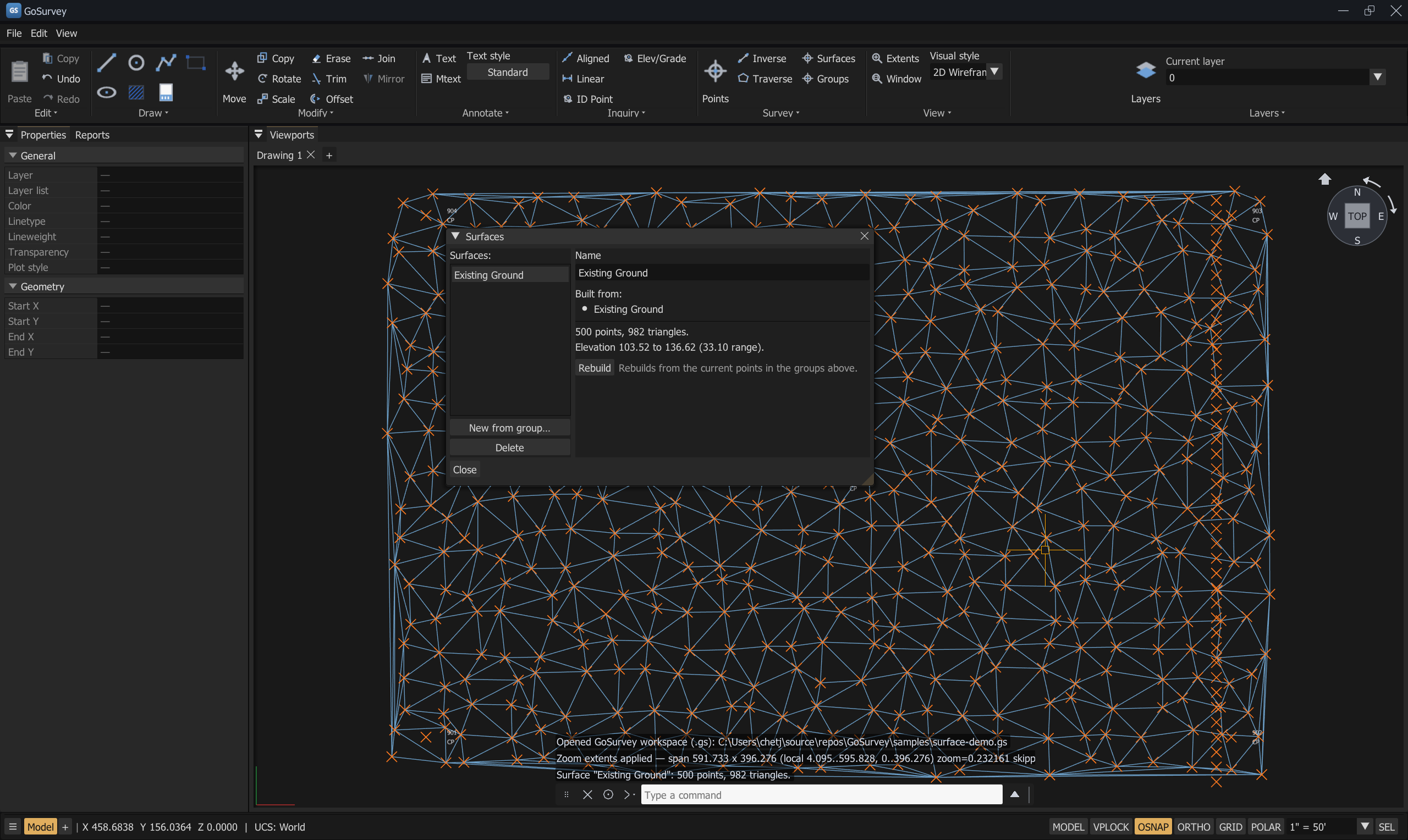
A surface built from the Existing Ground group — 500 points, 982 triangles, elevation 103.52 to
136.62 — with the TIN drawn behind it.
The surface list
| Element | Meaning |
|---|---|
%d points, %d triangles. |
What the surface was built from |
Elevation %.2f to %.2f (%.2f range). |
The elevation range covered |
| Built from: | The groups feeding it. A group that has since been deleted shows as (missing) |
Not built. |
The surface exists but has never been triangulated |
Rebuilding
Rebuild re-triangulates from the current points in the listed groups.
Rebuilds from the current points in the groups above.
Because groups are rules, importing more points that match a group and then pressing Rebuild is all it takes to bring a surface up to date. Nothing needs re-selecting.
Renaming and deleting
Rename surface and Delete surface are on the right of the panel. Both are confirmed in the command log.
Displaying a surface
A surface is drawn as its triangle edges — a wireframe mesh over the points.
Visual style does not shade a TIN. Setting Visual style to
SHADEDhas no effect on surfaces: they render as triangle edges in all three styles.SHADEDfills imported meshes (IMPORTMODEL) and hatches, not TIN surfaces. Lit surfaces are a planned feature, not a current one — see Known Limitations.
To read a surface in three dimensions, orbit it. Type ORBIT (3DO) and drag: the elevation
differences become obvious as the mesh tilts, which is the check that catches a bad shot or a spike
in the triangulation. SURFELEV gives you the numbers.
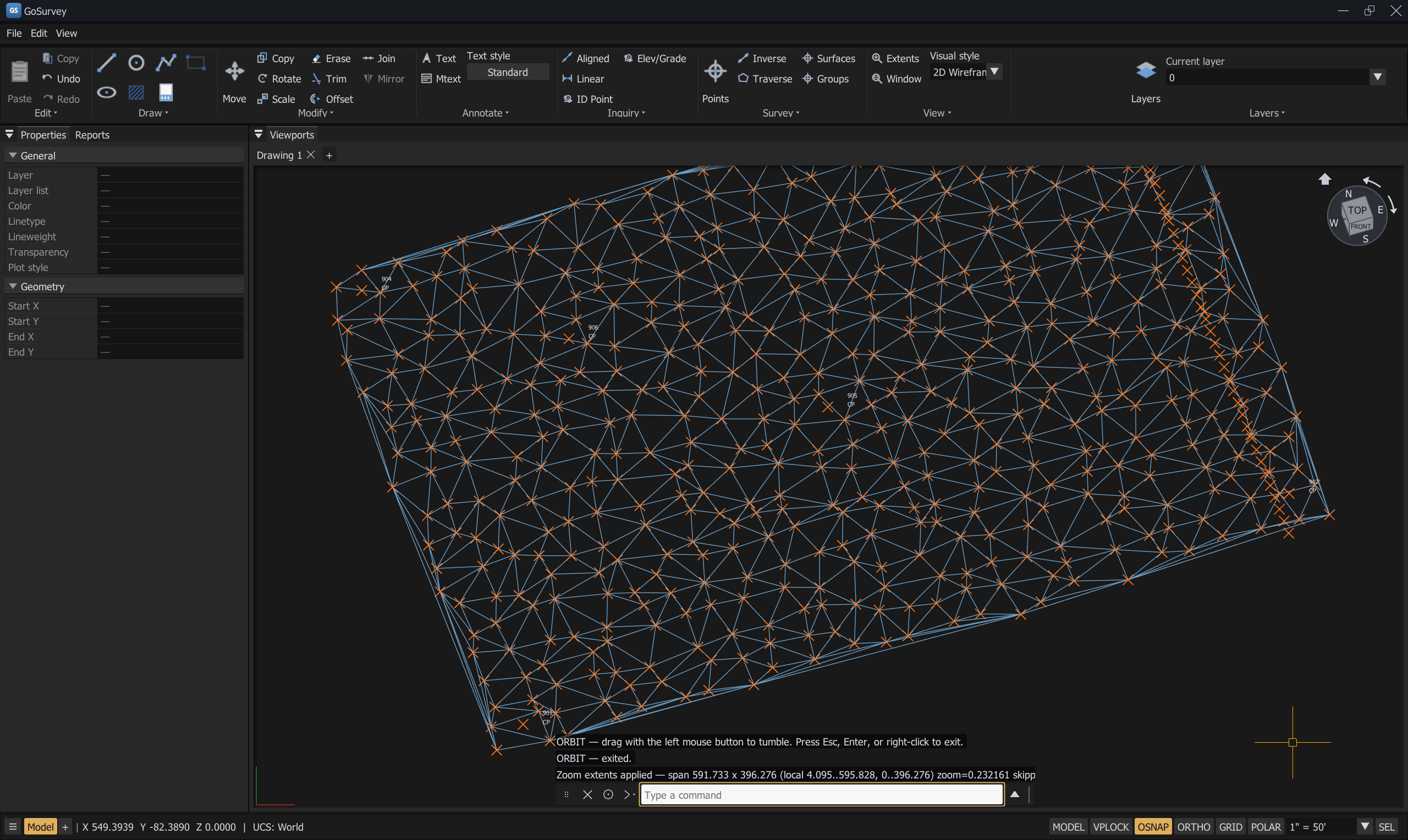
The same surface after ORBIT. The ViewCube (top right) shows the view is no longer plan. This is
a wireframe of triangle edges — no visual style fills it.
See Views and Navigation.
Reading elevations off a surface — SURFELEV (SE)
Ribbon: Inquiry → Elev/Grade Command: SURFELEV, SE
SURFELEV — pick a point for its surface elevation; pick a second for grade. ESC cancels.
SURFELEV: Pick a point for its surface elevation | ESC cancel
SURFELEV: Second point for grade | ESC stops after the elevation
- First pick — reports the interpolated elevation on every surface covering that point.
- Second pick — reports the grade, slope, and distances between the two.
A pick that falls outside a surface says so rather than extrapolating a number you should not trust.
With no surfaces in the drawing the command refuses to start:
SURFELEV — there are no surfaces in the drawing. Build one from a point group first.
A worked example
Goal: a ground surface from field shots, excluding the control points.
- Survey → Groups → New point group. Name it
EG. - Set Raw description matches to
EG*. The dialog reports how many points match. - Survey → Surfaces → New from group… Name it
Existing Ground. - Tick the
EGgroup and press Create. The panel reports the point and triangle counts and the elevation range. - Type
ORBITand drag to tilt the view — a 3/4 angle exposes spikes and bad shots that a plan view hides. - Use
SURFELEVto spot-check elevations against known shots.
Later, after importing a second day of shots coded EG:
- Survey → Surfaces, select
Existing Ground, press Rebuild. The new points are already in the group.
Common problems
| Problem | Cause | Solution |
|---|---|---|
New from group… is unavailable |
No point groups exist | Create one first in Survey → Groups |
| A group matches 0 points | Every criterion is empty, or the wildcard is wrong | An empty rule matches nothing by design. Try *EG* rather than EG |
| A group stopped matching after description edits | The rule is keyed on description | Key it on Raw description matches |
| Create is greyed out | Fewer than three points selected | Add more points or more groups |
| The surface is stale after an import | Surfaces are not rebuilt automatically | Press Rebuild |
A group shows (missing) under Built from |
The group was deleted after the surface was built | Recreate the group, or rebuild from a different one |
SURFELEV refuses to start |
No surfaces in the drawing | Build one first |
SURFELEV says a pick is off the surface |
The point is outside the TIN | It will not extrapolate. Add shots, or pick inside |
Related
Survey Points · Views and Navigation · Inquiry Commands · Traverse Editor